A fossil’s GPS location tells you where it was found yesterday. It doesn’t tell you where that spot was 200 million years ago. Tectonic plates don’t sit still. They drift. This makes reconstructing ancient geography a headache for paleontologists. Especially when they have to process thousands of data points using heavy, specialized software.
Enter the Paleocoordinates Calculator (PACA).
The BIOST3 Research Group at theUniversity of Barcelona just launched this open-access web tool. It turns modern coordinates into ancient ones. With near-desktop-level accuracy. You don’t need to code. You don’t need a supercomputer. Just a web browser.
Why PACA Changes How We Study Plate Tectonics
Mapping the earth’s shifting surface has always been hard. Conventional tools for reconstructing plate movements usually demand programming skills. Or experience with clunky desktop applications. This creates a barrier. Researchers miss out. Educators get frustrated. The public is locked out.
PACA breaks that wall down.
The interface accepts a CSV file. You upload current coordinates. You specify the geological age. The tool spits back the exact paleocoordinates in seconds. It’s that simple.
“This innovative interface removes methodological barriers,” says Professor Antonio Monleón-Getino. He heads the BIOST3 group. He’s also part of the Bioinformatics Barcelona platform.
The project follows open science principles. The source code is on Zenodo. The 3D conversion scripts are public too. Transparency matters. Reproducibility matters. Now, anyone can trace locations through deep time. Regardless of their computing experience.
Which Plate Tectonic Model Should You Trust?
Here’s the messy part. Earth science isn’t always clean. Different models of plate motion give slightly different results. PACA doesn’t hide this uncertainty. It highlights it.
The tool uses the R package palaeoverse. This connects to the GPlates web service. Users can compare their data against five global plate models (GPM). The big names?
- PALEOMAP
- GOLONKA
- MERDITH2021
- TorsvikCocks2016
- MATTHEWS2016_pmagic_ref
Why does this matter? Because different models disagree. PACA automatically calculates the differences. It measures the paleolatitudinal range. It calculates the greatest geographic distance in kilometers between predictions. This gives an immediate estimate of tectonic uncertainty. Is your fossil site drifting wildly between models? Or is the consensus strong? You’ll know right away.
Accuracy: Web vs. Desktop Software
Skeptics ask: “Does moving to a web interface reduce accuracy?”
No.
The BIOST3 team tested this rigorously. They used cross-validation on 142 reconlocations from around the globe. The automated PACA results were almost mathematically identical to the conventional GPlates workflow.
The average spatial error? Less than 17 meters. At a planetary scale, that’s negligible. The concordance correlation coefficient (CCC)? 1.000. For every single model. No systematic bias. No data rot. Just precision.
Visualizing the Deep Past
Numbers are fine. But seeing is better.
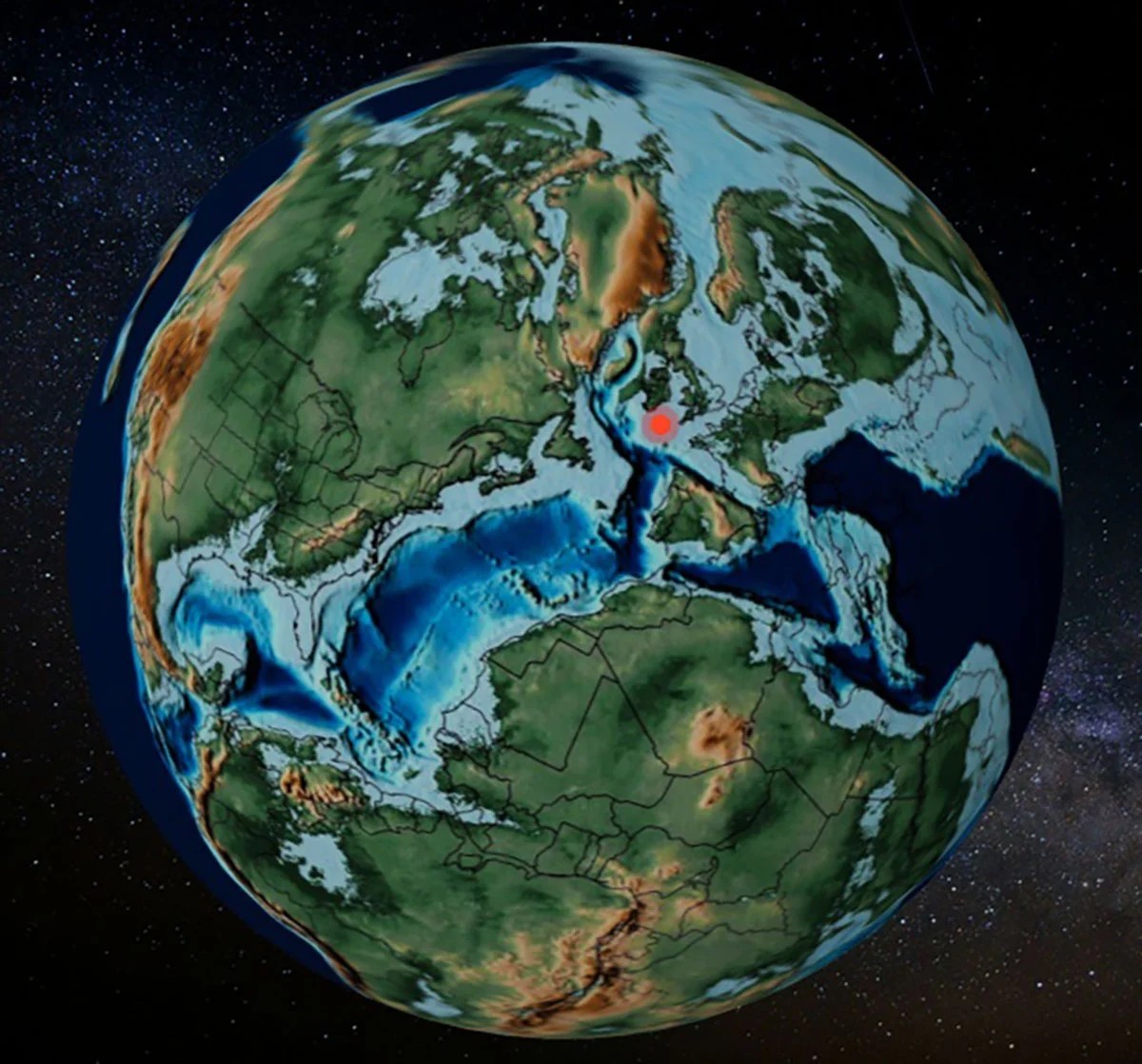
PACA includes an interactive 3D display. Built with React and Blender. It places calculated points directly onto paleogeographic maps. These maps come from the PALEOMAP Project. Created by geographer Christopher Scotese. Adapted to the International Chronostratigraph Table.
You can export optimized tables for further statistical analysis. You can spin the globe. See where your fossil sat when dinosaurs walked the earth. Or when the supercontinent Pangaea was whole.
Who Is This For?
PACA was born from the “Cretaceous Resin Interval” project (CREI). Funded by the Spanish Ministry of Science. Coordinated by Antonio Monleón-Getino and Xavier del Clòs. The project investigates the massive production of resin during the Cretaceous. Resin that fossilized into the amber we treasure today.
But the utility goes beyond amber.
- Researchers: Process large datasets without writing code.
- Educators: Show students exactly how continents moved.
- Amateurs: Satisfy curiosity about ancient geography.
The paper describing PACA was published in Scientific Reports on June 15, 2026. By Noa Scholz-Murcia. Along with Rodríguez-Mena, Madarnás-Gómez, and Monleón-Getino. DOI: 10.1038/41598-s41598-020-46309z.
It’s open access. It’s free. It’s powerful.
We spend so much time looking down at the ground beneath our feet. Assuming the earth is static. But it’s alive. It’s moving. PACA lets us look up. And back. Into a time when the map looked nothing like the one on our walls today.
So where was that fossil 200 million years ago?
Probably somewhere you wouldn’t expect.